Trail orienteering
The map
The map is enlarged to a scale of 1:5 000, which is usually used for competitions. For other events, a scale of 1:2 000-1:10 000 might be used.
The course
The course length is usually about two kilometers, with plenty of time available. The maximum time is calculated based on the course length plus the number of controls (usually about two hours).
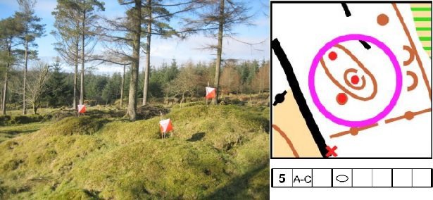
A course consists of 15 to 30 controls. Each control has up to five flags, where you need to decide which one is correct.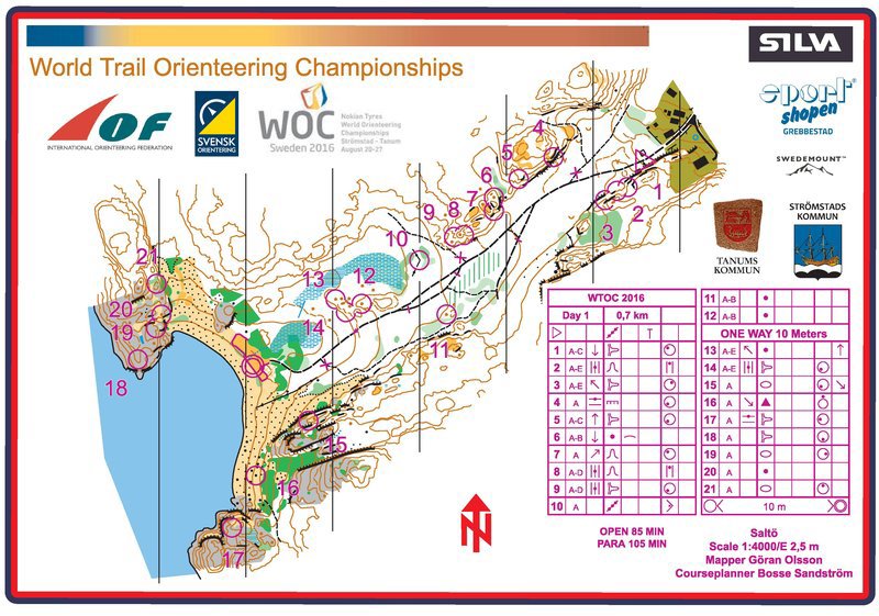
Above is a competition map from the TrailO World Championship in Strömstad 2016, which includes the related control description.
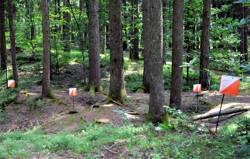
The control
The controls are different kinds of terrain features, such as boulders, knolls and re-entrants. On the map, these are marked with a circle, and in the terrain with orange-white flags.
Between one to five flags are placed at each control, and it’s up to the competitor to determine which flag is correctly placed. For the elite and A-classes, there’s also the option that none of the flags are placed correctly, a so-called false control.
Try TrailO
Find upcoming competitions at Eventor.